
MGS MOC Release No. MOC2-240, 22 June 2000
|
|
|
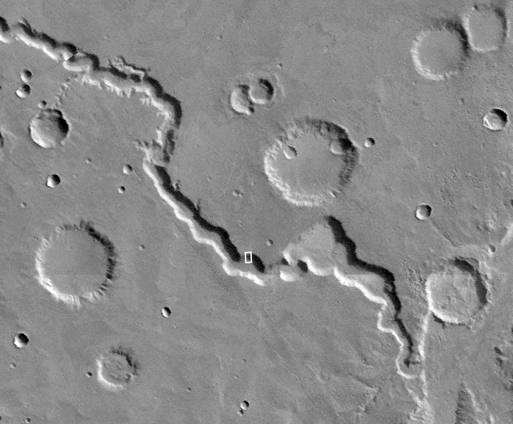
Nirgal Vallis is the one location where martian gullies thought to be related to recent groundwater seepage have been found closer to the equator than 30° latitude. All of the features in Nirgal, however, occur close to 30°--they are all between 27°S and 30°S. The MOC image is near 29.7°S, 38.6°W, and was obtained July 12, 1999. The MOC picture covers an area approximately 2.3 km (1.4 mi) wide by 2.8 km (1.7 mi) long. Sunlight illuminates the MOC scene from the upper left, and north is up. The context view (right) is a mosaic of Viking orbiter images illuminated from the upper right from the U.S. Geological Survey Mars Digital Mosaic maps. The small white box in the context frame (just below center of image) shows the location of the high resolution MOC view.
It is ironic to note that one of the first pictures returned to Earth from MOC, back on September 21, 1997, showed similar small channels and aprons on the wall of Nirgal Vallis--but their significance was not realized at the time.
Images Credit: NASA/JPL/Malin Space Science Systems
Malin Space Science Systems and the California Institute of Technology built the MOC using spare hardware from the Mars Observer mission. MSSS operates the camera from its facilities in San Diego, CA. The Jet Propulsion Laboratory's Mars Surveyor Operations Project operates the Mars Global Surveyor spacecraft with its industrial partner, Lockheed Martin Astronautics, from facilities in Pasadena, CA and Denver, CO.

 To MSSS Home Page